Barking & Dagenham Character Study
View all projectsMade in Barking & Dagenham
This character study interrogates the social and physical evolution of Barking & Dagenham through extensive research of spatial forms, social history, growth challenges and opportunities. With input from residents and a holistic review of the borough's functional and cultural attributes, it positions the borough to create mixed, liveable neighbourhoods. The study has been a mirror to this changing part of east London, reflecting what is there, so it can better plan for a resilient future.
Context
The pressure for housing within London and the shift of development eastward has positioned the Borough of Barking & Dagenham for growth. Located in east London, and with a population of 210,000, the borough has scope top increase the number of homes by 70% over the next 15 years. There is a significant amount of industrial land that could be released to accommodate this growth. This new wave of intensification should be delivered as liveable neighbourhoods with access to jobs, shops and social infrastructure, building on the intrinsic qualities of the existing communities.
Recognising that understanding character will help to ensure such a sustainable evolution, the Council commissioned us to undertake a characterisation study that would analyse the existing physical, functional and socio-economic fabric of the borough. This would then present an opportunity to explore the ways in which future densification could be delivered in a place-sensitive way.
Marks Gate
Chadwell Heath
Beacontree Heath
Rush Green
Beacontree
Dagenham East
Barking Town Centre
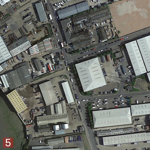
Barking Riverside and Thames View
Dagenham Riverside
Faircross Leftley & Upney
The borough today
Challenge
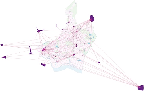
This was a highly analytical research project that required a nuanced understanding of place beyond bricks and mortar. Inherent in any London borough, the boundaries of Barking & Dagenham do not always correlate to the day-to-day functioning of its communities. The town centre of Barking is the commercial centre but sits at the edge of the borough. Areas such as Romford, Ilford and Stratford are destinations for borough residents, even though they sit outside its boundaries. So, it was important to understand how these shaped the behaviours of those in the borough.
Connectivity is another key challenge to integrating neighbourhoods within the borough. Barking & Dagenham is traversed east-west by London's radial transport infrastructure while north-south connections are not as strong. Rail lines, the tube network and strategic roads all create divides but they also underpin distinctive, separate identities for the Riverside, Barking, Dagenham and Chadwell Heath. Any recommendations that would shape future evolution of the borough would need to take these realities into account in order to overcome these divides.
London
Westfield
Ilford
Romford
Lakeside
Gallions Reach
East Ham
ASDA Dagenham
Rainham Tesco
Beyond boundaries: where residents shop
Concept
The project broadly involved two main aspects: the first was to chart the borough's evolution and the second was to offer a high-level roadmap for future intensification at key sites.
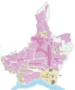
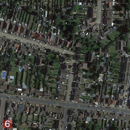
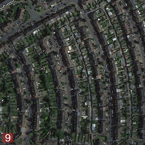
We plotted physical evolution over time to understand where people lived, to role different centres played and how these were connected. GIS mapping helped to identify the areas with the greatest population density as well as the typologies and layouts of their buildings. In areas identified for new homes, densities are naturally set to increase, so area strategies explored how borough-specific typologies and layouts could be replicated to deliver this densification. At the Becontree Estate, for example, we identified a minimum of sixteen distinct dwelling types. The study celebrated these and then asserted that a contemporary scaling up of these local, seemingly ordinary, forms of housing, could meet future housing needs.
An essential finding was that the demographic profile of the borough was changing. Census data was used to plot socio-economic characteristics from the 1850s onwards, and we also conducted genealogical analysis to help tell the social history of the borough. Census data showed that until 2001, the borough very much mimicked Essex in terms of ethinic diversity, yet asserts that by the 2021 census, this would have changed rapidly as it adopted characteristics more in keeping with inner London boroughs. GIS pointillism maps beautifully illustrated this diversity.
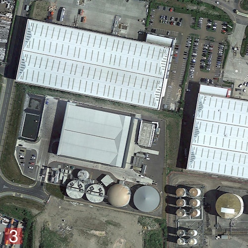
Our research also suggested that the borough is well-positioned to nurture a 21st century economy with many locations that could integrate industry and homes. There is a richness of existing, and often vacant, industrial land and buildings that can accommodate new housing and figure ground analyses revealed the extent of unused land available in certain locations across the borough. In the end, 14 area strategies were developed, including for the Becontree Estate, Barking Riverside, Barking Town Centre, Dagenham East and Chadwell Heath. The study culminated in borough-wide recommendations for the sustainable management of growth, especially housing-led intensification, into the future.

1/5
Urban typologies analysis
2/5
Dagenham Riverside
3/5
Barking Riverside
4/5
Dagenham East
5/5
Cavendish Gardens
Process
The project involved using a range of research methods and analytical tools, combining interviews and consultation events, GIS mapping, fieldwork and the mining of census data. Historical research provided not just a timeline of the borough's development, but it allowed us to identify key drivers that shaped physical character, including key growth spurts, and what lessons these could offer.
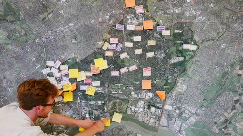
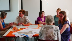
We were particularly interested in how people viewed their borough. We held a range of events and activities early in the process to understand this. These ranged from tea and cake sessions at local care homes to market stalls in frequently trafficked areas to creative drop-in workshops. The interviews and interactions formed an essential part of the qualitative research.
Impact
As a characterisation study, the project was innovative in several ways. The extensive use of social history and analysis - on people, of families, the stories of individuals who have lived in the borough - have been incorporated. This is important because studies of this nature have tended to focus on built history and fabric.
Extensive public engagement and opinions were sought, and the creative ways in which these were undertaken, all added to the richness of the outputs. Highly detailed mappings of different aspects of borough life were created. In rich detail, these vividly and beautifully illustrate what the borough is like today, equipping the Council with an important tool to inform its future planning decisions.
Information table
- City
- London IG
- Use
- Mixed
- Client
- London Borough of Barking & Dagenham
- Status
- Completed
- Awards
New London Awards Masterplan & Area Strategies Commendation 2018